Mangalore (India)
Cruise Port schedule, live map, terminals, news
Port Mangalore cruise ship schedule shows timetable calendars of all arrival and departure dates by month. The port's schedule lists all ships (in links) with cruises going to or leaving from Mangalore, India. To see the full itineraries (ports of call dates and arrival / departure times) and their lowest rates – just follow the corresponding ship-link.
| Day | Ship | Arrival | Departure |
|---|---|---|---|
| 5 April, 2025 Saturday | 09:00 | 19:00 |
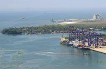
The cruise port is in the New Mangalore Port, part of Mangalore Harbour. This is a deep-water seaport located at the city's Panambur district, Mangalore Harbour is India's deepest inner harbor waterway and the only major port on Karnataka region's coastline. The port is ranked India's 7th largest cargo port. All facilities are managed by the government-owned company New Mangalore Port Trust.
Karnataka (aka Karavali) has a 300 km (186 ml) long coastline stretching between Mangalore (Dakshina Kannada district) and Karwar (Uttara Kannada district) along Arabian Sea's eastern shore. On the coastline are locatd one major seaport (Mangalore) and 10 smaller ports.
Port Mangalore
The port was named "New Mangalore Port" to distinguish it from Mangalore Harbour (aka "Old bunder"). The old port is located south of the new port. The new port in Panambur is to north of the confluence of Gurupura River to Arabian Sea. The port is located approx 310 km (190 ml) south of Port Mormugao (Goa) and approx 354 km (220 ml) north of Port Cochin.
Facilities at Mangalore Harbour serve the port's cargo storage and logistics. New Mangalore Port handles cargo vessels (fluid-, dry- and bulk carriers), also tankers (carrying petroleum oil lubricants, crude oil products, LPG / Liquid Gas Tank containers), ferries and cruise ships. At the new port there is also an Indian Coast Guard station.
New Mangalore Port is a man-made harbour waterway through which cargo and passenger (ferry and cruise) ships enter the city. All vessels use e-Visa. Cruise ships come to Mangalore from Europe (Mediterranean, eastbound routes via Suez Canal and often Dubai) and also from Australia and even USA (westbound routes, usually as part of World Cruise itineraries).
This seaport is strategically located between Western Ghats (mountain range parallel to the peninsula's west coast / UNESCO World Heritage Site) and Arabian Sea's eastern shore. Currenntly, the port exports around 3/4 of India's coffee, cashew nuts and spices. The port's current total capacity is around 78 million tonnes.
Among the port's major exports are iron ore (concentrates, pellets, fines), manganese, granite stones, coffee, cashew nuts, spices, containerized cargo. Among its major imports are crude oil, petroleum products, LPG (liquefied petroleum gas), wood pulp, timber logs, fertilizers, liquid chemicals (including ammonia and phosphoric acid), as well as various containerized cargo.
Follows the list of Mangalore port's berths, their wharf lengths (in meters) and the type of cargo that each of them serves.
- Berth 1 (125 m), Berth 2 (198 m), Berth 3 (198 m), Berth 6 (198 m), Berth 7 (200 m) and Berth 8 (350 m) all serve General and Bulk Cargo vessels, also Container ships and Passenger ships (ferry and cruise).
- Berth 4 (198 m) serves General and Bulk Cargo, Container ships, Liquid carriers (Ammonia and Phosphoric Acid) and also Passenger ships (ferry and cruise).
- Berth 5 (198 m) serves General-Bulk Cargo-Container ships, Bulk Cement carriers, Edible Oil tankers, and also Passenger ships (ferry and cruise).
- Berth 9 (300 m) serves Coal carriers.
- Berths 10 and 11 serve General-Bulk Cargo-Container vessels.
- Berth 12 serves Bulk-General Cargo vessels.
- Berth 13 (330 m) serves LPG (gas) carriers.
- Berths 14 and 15 (320 m) serve Crude Oil tankers.
- Berth 16 (320 m) serves liquid carriers (Chemical / Edible Oil).
- Berth 17 (350 m) serves serves gas- and liquid carriers (Crude Oil / LPG / Chemical).
- Berth 18 (300 m) serves General-Bulk Cargo vessels, including Iron Ore carriers (export).
- Berth 19 is a Multipurpose Berth.
The new port was officially opened on May 4, 1974. Construction works started in 1962. The port is connected via NH-66 highway and Konkan railway (nearest train station Thokur is approx 6 km from the cruise port).
Port Mangalore is palm-fringed and also contains the remnants of Tippu Sultan (naval port). The fort was first mentioned in the 14th century as one of the country's major forts. Later, Mangalore became a key entrepot (main import / export port) during the Kingdom of Mysore (1399-1950). On Gurupura River and NNetravati River are offered boat tours into the countryside.
- Cruise Industry
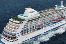
Regent's ship Seven Seas Voyager docks at New Mangalore Port on Arabian Sea cruise
The Bahamas-flagged ship Seven Seas Voyager, the season's second vessel, made a scheduled call at India's Port New Mangalore Port (NMP) on Friday...
December 27, 2024 - Cruise Industry
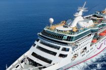
Cordelia Cruises India to add major ports in West Asia from June 2024
According to Jurgen Bailom (President & CEO of Cordelia's parent company Waterways Leisure Tourism Pvt Ltd), the India-based travel brand...
July 9, 2023 - Cruise Industry
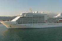
Silversea introduces 86 new cruises for winter 2021-2022
The top-premium travel brand Silversea unveiled 86 new itineraries for winter 2021-2022 season and opened an exclusive pre-sale promo to its Venetian...
June 6, 2020 - Accidents

India Bans Foreign Cruise Ships
India banned all foreign cruise ships from its ports due to the Coronavirus, with one European ship turned away from the port of Mangalore in the...
March 9, 2020 - Cruise Industry
India Boosts Cruise Tourism Industry
In India, rising household incomes and robust economic growth are giving a boost to cruise industry. Currently, more people are opting to spend...
July 2, 2018 - Cruise Industry
Cruise Passengers with E-Visa to Be Exempted From Biometric Enrolment Until 2020
With a view to promote cruises in India, cruise passengers with e-visas will be exempted from the requirement of biometric enrolment until December...
January 3, 2018 - Cruise Industry

Mumbai Port to Be Home for Costa neoClassica
Costa neoClassica will operate from Mumbai between November 2017 and March 2018, returning to her homeport every fortnight. In a bid to woo...
November 26, 2017 - show more news

 82°F
82°F 
 Gentle breeze