Santa Marta Colombia
Cruise Port schedule, live map, terminals, news
Region
Bahamas - Caribbean - Bermuda
Local Time
2025-04-03 03:12
 77°F
77°F 25.2°C

 Mod. breeze
7.6 m/s
 84 °F / 29 °C
 72 °F / 23 °C
Port Santa Marta Colombia cruise ship schedule shows timetable calendars of all arrival and departure dates by month. The port's schedule lists all ships (in links) with cruises going to or leaving from Santa Marta Colombia. To see the full itineraries (ports of call dates and arrival / departure times) and their lowest rates – just follow the corresponding ship-link.
| Day | Ship | Arrival | Departure |
|---|---|---|---|
| 5 April, 2025 Saturday | 07:00 | 16:00 |
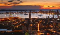
Santa Marta is a major Caribbean port city and the capital of Colombia's Magdalena Department, with population around 455,000. Colombia's other Caribbean cruise port is Cartagena, located approx 170 km (107 mi) to the east-southeast. Columbia's principal port (and the country's largest by annual shipping volumes) is Buenaventura.
Santa Marta Port (locode COSMR) annually handles around 10 cruise ship calls and ~10,000 tourists. During season 2024-2025, the Port had booked 24 ship calls with estimated ~15,000 cruisers. In 2024, Colombia reported record-breaking numbers of international tourists - over 6,6 million (8,5% increase over 2023). Most tourists arrive from the USA and, Mexico, also from Ecuador, Chile and Peru.
The city is located on Santa Marta Bay (Caribbean Sea), approx 992 km (616 mi) from Bogota (Colombia's capital and largest city). Santa Marta was the first Spanish settlement in Colombia (1525-founded). It is also the country's oldest surviving city and South America's second-oldest - after Quito Ecuador.
The city's economy is based on shipping trade, port activities, tourism, agriculture, commercial fishing. Main agricultural products are bananas, cocoa, coffee, cassava.
The city is served by its seaport and Simon Bolivar International Airport (approx 16 km / 10 mi) from downtown. As downtown is close to the coast, the city has difficulties to expand. Rodadero (separate locality) is often considered as neighbourhood.
- Cruise Industry

Azamara introduces maiden ports in 2025-2026 winter cruises
Azamara Cruises has unveiled its winter sailings for 2025 and 2026, introducing visits to 8 maiden ports and lesser-known destinations accessible...
April 13, 2024 - Cruise Industry

Colombia's promising cruise season to conclude in June 2024
Colombia is set to unveil a promising cruise season that will conclude in June 2024, emphasizing the exploration of emerging destinations within the...
October 26, 2023 - Cruise Industry

Ritz-Carlton unveils 2024-2025 winter Caribbean cruises for the ships Evrima and Ilma
On August 15th, 2023, The Ritz-Carlton Yacht Collection made an announcement regarding its highly anticipated 2024-2025 winter Caribbean schedule for...
August 18, 2023 - Cruise Industry

AIDA Cruises announces winter 2024-2025 itineraries (380 departure dates)
2024-2025 winter vacations with AIDA Cruises feature 380 departure dates that are bookable as of now. The destinations range from the Caribbean to...
April 23, 2023 - show more news
