Venice Islands (Italy)
Cruise Port schedule, live map, terminals, news
Region
Europe Rivers
Local Time
2024-11-23 14:08
 46°F
46°F 7.5°C

 Light breeze
1.8 m/s
 46 °F / 8 °C
 34 °F / 1 °C
Port Venice Islands cruise ship schedule shows timetable calendars of all arrival and departure dates by month. The port's schedule lists all ships (in links) with cruises going to or leaving from Venice Islands, Italy. To see the full itineraries (ports of call dates and arrival / departure times) and their lowest rates – just follow the corresponding ship-link.
| Day | Ship | Arrival | Departure |
|---|---|---|---|
| 9 May, 2024 Thursday | 14:00 | 18:00 | |
| 15 May, 2024 Wednesday | 14:00 | 18:00 | |
| 25 May, 2024 Saturday | 14:00 | 18:00 | |
| 27 May, 2024 Monday | 14:00 | 18:00 |
The Venice Lagoon is an enclosed bay of Adriatic Sea, located in northern Italy, in which Venice city is situated. Its name in the Venetian and Italian languages, Laguna Veneta (which is cognate of Latin lacus/lake) provided the international name for a shallow, enclosed embayment of saltwater, a lagoon.
The Venetian Lagoon stretches from River Sile in the north to Brenta in the south and has a surface area of 550 km2 (212 mi2). It is about 8% land, including Venice and plenty of smaller islands. Around 11% is covered by open water, canal, as the dredged channels' network are called, while about 80% consists of tidal shallows, salt marshes and mudflats. The lagoon is the biggest wetland in Mediterranean Basin.
MOSE - Venice flood barrier project
MOSE project is designed to protect Venice and the Venetian Lagoon from flooding caused by high tides (up to 3 m / 10 ft). The integrated system consists of rows of large mobile gates at 3 inlets (Lido, Malamocco and Chioggia) through which Adriatic Sea water enters and leaves the Venetian Lagoon.
These gates are able to temporarily isolate the lagoon from the sea during high tides as they open and close separately thus controlling the water flow.
In the Mose system's control center is in Venice's Arsenal, where 9 people constantly monitor the lagoon's conditions. The monitoring staff's training started in 2011 by simulating real-time flood defense operations. During that period was also collected data about water levels, waves, water pressure, fresh river flood.
Flooding due to high tides mires Venice during winter months. During high tide forecasts, sirens all over the city sound a warning, and real-time information is provided (online and via mobile phones). Other measures are setting up temporary elevated platforms in city parts with heavy pedestrian traffic.
High tides usually last 2 1/2 hours.
Venice's flood of November 4th, 1966, saw water levels reaching up to 194 cm (6 ft). This was the end of agriculture in the lagoon and also resulted in the death of the majority of its plants. Previously, the lagoon was a winemaking region.
The Mose barrier concept was first proposed in 1988.
The consortium Venezia Nuova was contracted by Italy's Ministry of Infrastructure and Transport.
Construction works (simultaneously at all 3 lagoon inlets) started in 2003.
The project also included other anti-flood measures - coastal reinforcement, raising quaysides, lagoon improvement.
The project was 85% completed in 2014. In 2016, the gates arrived and were inserted into their concrete foundations.
The project's total cost is EUR 5,4 billion (GBP 3,9 billion). Completion is scheduled sometime between 2018-2020.
Construction works on the MOSE system were slowed due to investigations into corruption, with allegations of bribery and illegal political parties financing. The investigation resulted in 35 arrests (in June 2014). Among the arrested was Consorzio Venezia Nuova's former president, who was accused of diverting funds to Venice's mayor for financing his campaign for office in 2010.
Construction works included pre-building concrete foundations (23,000 tons each), then lowering them into the lagoon. Gates have spares (for each inlet), which allows to be removed every 5 years (for maintenance) without interrupting the barrier's service. All hinges on the gates are equipped with a waterproof camera that permits removal operations to be accurately monitored and controlled.
The commercial harbor is impacted each time the gates are lifted. The amount of electricity used for the operations is also considerable.
Venice City was established in the 7th century as a cluster of all 124 island settlements.
Venice Islands cruise terminal
The largest Venetian Lagoon Islands or archipelagos by area (excluding the coastal barrier beaches and coastal reclaimed land) include Venice Island (5.17 km2), Sant Erasmo Island (3.26 km2) and Murano Island (1.17 km2).
Originally many of the Venice Lagoon Islands were marshy, but a programme of drainage made them inhabitable. Many of the smaller isles are entirely artificial. Some areas around the seaport of Mestre are reclaimed islands. The remaining are essentially dunes, including the ones of the coastal strip (Treporti, Pellestrina and Lido).
Venice Islands tours, shore excursions, hotels
City Tours and Shore Excursions
- Burano Island - brightly painted houses, San Martino church, Lacemaking Museum
- Murano islands (glassmaking)
- Torcello Island - Santa Maria Assunta cathedral (founded 639 AD), Santa Fosca church, Museum (housed in two 14th century palaces (Archivio and Consiglio), Attila’s Throne (ancient stone chair), Ponte del Diavolo (Devil's Bridge)
- Cruise Industry
Swan Hellenic's 2025 Cultural Expedition Voyages Unveiled
Swan Hellenic, renowned for pioneering cultural expeditions, presents an array of enriching itineraries spanning West Africa, the Mediterranean...
January 31, 2024 - Cruise Industry
Sea Cloud Cruises' tall ships continue sailing into the heart of Venice (Italy)
Sea Cloud Cruises fleet will again steer a course for Venice Italy's historic downtown in 2023. Unlike large vessels, Sea Cloud's tall-sailing ships...
March 8, 2023 - Cruise Industry
Azamara returns to Venice with 12-night The Best of The Med cruise on Journey ship
The ultra-premium travel brand Azamara announced its return to Venice City (Italy), on April 3, 2023, as part of the 12-night The Best of The Med...
October 19, 2022 - Cruise Industry
50,000+ people sign a petition to ban polluting cruise ships from Port Marseille (France)
50,000+ people signed a petition to ban large cruise liners from Marseille (France). Marseille Fos port city is one of the busiest European cruise...
September 2, 2022 - Cruise Industry
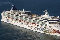
NCL Norwegian Gem passengers ferried into Venice City on small boats due to large ship ban
NCL-Norwegian Cruise Line circumvented the ban on its ships entering Venice Lagoon by shuttling cruise passengers into the city centre on motor boats...
July 26, 2022 - Cruise Industry
Seabourn updates restart date for its Seabourn Quest ship
The ultra-luxury cruise brand Seabourn continues to work with government and port officials in order to develop plans for the full return of cruising...
September 9, 2021 - Cruise Industry

Italian Government bans large cruise ships from entering Venice starting August 1
Italy banned cruise ships from the Venice Lagoon in a move welcomed by anti-cruise ship campaigners. After Unesco threatened to put Venice on its...
July 14, 2021 - Cruise Industry

Unesco puts Venice on endangered list if cruise ships not banned
The UN art heritage agency Unesco recently said it would examine a proposal to put Venice Italy on its endangered list if the lagoon city doesn't...
June 27, 2021 - Cruise Industry

3 cruise ships scheduled to call in Venice, Italy this month
This month 3 cruise ships are scheduled for regular calls at Port Venice Italy. The return of the liners after a 17-month ban saw the first vessel...
June 13, 2021 - Cruise Industry

Cruise ships no longer allowed to sail past St Mark’s Square in Venice
Cruise ships will no longer be allowed to sail past St Mark’s Square in Venice Italy, and instead will dock at the Venice Lagoon (the city's...
March 26, 2021 - show more news
